Day 10:
Here is a shot of us leaving the campsite and the "neighbors" - an elderly couple who were there to fish.

As Stephanie was taking this photo I distinctly remember having that gut-wrenching/dropping feeling of something not right with the car. Every morning I went through a pre-trip checklist of all vital fluids and connections. I did that on this day but I stopped right here just past those rocks on the left to make sure we didn't have a flat or one axle-shaft locked in 4wd.
I was hearing the dreaded whump-whumping coming from the front right wheel. I went through possible causes: air pressure at 30psi (to ease the rough roads/provide traction when needed) - right where it should be and had not been making noise before, axle not locked in 4wd - nothing there, tie-rod end dust covers were beginning to crack but not bad enough to effect anything, diff fluid good, trunion grease good, only obvious thing left was the wheel-bearings.
It was hard to tell the difference as driving on gravel is loud as it is but I knew that something was wrong and I thought or thought I imagined that the slight whump-whumping got worse as weight shifted to that side of the car in turns. Nothing to do but keep going now and we had some stout days ahead of us.
I prayed the front end would hold together until Telluride/Norwood where we would stay with family and have access to a garage.
We continued on and I tried to stop listening and analyzing every sound or thump from the front of the truck.
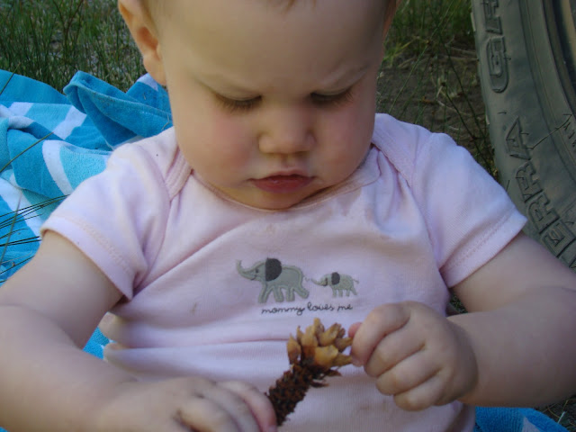
Larkin giving her two-cents about the problem.
And playing with her new toy.
It's funny now looking back at the trip. The only world she remembers is being outside all the time or in the car traveling. Her cognizance is just so limited and she really came into interaction with the world (age-wise) during the trip. Now, August, she points at the front door and says (maybe second or third word ever), "outside, outside."
Lakecity - where gas was expensive and groceries were not to be had. We decided to wait for both until we got over the passes into Ouray.
Up the road we went, past this reservoir and onto the road that leads to Cinnamon Pass.
I'm not sure why I chose Cinnamon over Engineer Pass. I'd seen many photos of Engineer but very few of Cinnamon. Also I was hoping it would be somewhat less exposed in order to ease the family into driving these precipitous roads that seemingly barely cling to the mountainsides.
The ascent begins.
At this point I hear yelling in my ear, "You can't look down there! Don't take your eyes off the road!" But look at the beautiful river down there.
American Basin. Oh, this is one reason I wanted to come up Cinnamon. I've been dying to hike here.
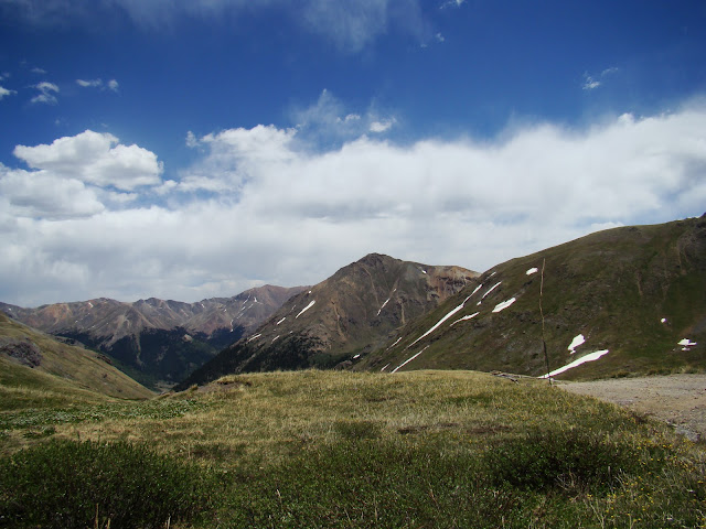
Cool horizon line.
Looking back at American Basin and the switchbacks that lead to the pass.
Looking up at another switchback with one below as well.
"Yep, we're going up there. See, you can just make out the cut of the road." -Jesse
"I'm going to be sick."-Stephanie
And, indeed, somewhere along the top while we were listing over towards the edge of a serious drop-off on an off-camber section, she exited the vehicle while in motion and began walking.
Poser-calendar shots. Sorry.
Wildflowers were out...
...and my daughter is...naked? at 12,000'
I guess I'll have to photo-chop her out of this for the calendar.
Lunch stop. The kids climbed up to the snow and I showed them how to glissade on their arses. They had a blast. At one point trying to chase them down I asked Bailey why he was having a hard time breathing. He didn't know and I tried to explain the concept of thin-air to him. It went right over his head.
Cinnamon Pass
Steph doing what she does.
Looking down the other side.
And the descent.
We descended and then took a connector trail that you can't see in these photos back towards Engineer Pass planning to descend down Mineral Creek. I'm not sure of that trail name but the GPS (updated in 2011) did not show that the trail we were planning on driving went through. On the gazetteer it looked like it went through but was very steep. I think this trail parallels and is easier than Poughkeepsie Gulch. Not knowing if the trail went through did cause some tension.
Steep!
And then down along this trail. Maybe called Mineral Creek?
My wife was not very excited and kept telling me how she never wanted to do this exposure again.
"Oh don't worry," I replied. "We won't until...tomorrow."
This one is not scared in the least. We had to put sunscreen on him often.
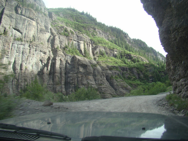
The trail was narrow and somewhat technical for a big vehicle and only a 2.5" lift.
Not sure what I'm looking at here. Maybe lining up for something ahead of me. it looks worse in the background.
I don't know. Pictures rarely do justice to the difficulty or intensity of situations.
The off-camber-ness and the narrow lines were what really added stress. Traction was not often an issue.
The entire time you are weighing the options of different lines you can take when they're available. The biggest concern for me was not catching the undercarriage and staying aware of the weight on top. I chose the top line her because of the tall rock on the low line.
And we made it! Note that we didn't see another truck up there the entire day. Imogene Pass opened two days before and I have no idea how long this trail that we ran had been open. We only say ATVs and side by sides.
And they looked at us like we were crazy.
After gas, groceries and play time for the kids in the hot-springs we drove up Camp Bird road towards the Sneffels Range, Yankee Boy Basin and Imogene Pass.
I drove this road when I was 16 and this brought back fond memories. The first fourteener I climbed was up this road: Sneffels Peak.
We camped somewhere near here, not in Yankee Boy Basin but very near.
High Camp, almost our highest for the trip.


2 comments:
Okay...so 50something year old Bitsy is VERY glad she joined you after this road. Made what we did look like a breeze. All I can say is...My son ROCKS! Or he is crazy. I prefer rocks!
Now we know why you didn't post these until you got back!
Post a Comment